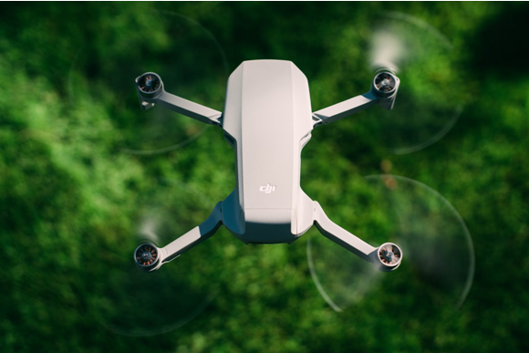
Drone technology has changed many fields, such as film, agriculture, security, construction, and surveying. The rise and use of unmanned aerial vehicles (UAVs) has seen people and firms spend less resources while obtaining amazing results.
Surveying is one sector that extensively uses UAVs to conduct different kinds of surveys. Whether you are talking about land, mining, engineering, or topographic surveys, the use of drones these days is extensive.
Using drones has cut expenses on projects that would cost thousands of dollars to a fraction of the total cost. Also, these devices are small and easy to operate, meaning they can be deployed when needed. Consequently, the team can always use the latest data when planning.
So, are you preparing a land surveying project? Find out the advantages of using drones for land surveying.
1. High Accuracy and Precision

One feature that makes drone surveying these days popular is the accuracy and precision. Unlike when 3D mapping took weeks and months, drones have enabled the process to take a few hours.
Drones are accurate and precise due to the integrated technologies. A survey drone is equipped with sensors and various types of cameras to help capture HD images. Besides, the drone features geolocation technologies that allow photos to be tagged with accurate coordinates.
Other than this, the drones have light detection and ranging (LiDAR) technology for measuring distance and other data collection. They deliver highly accurate maps by combining imaging, geolocation, and sensing technologies.
Amazingly, land surveying drones have powerful software that generates different maps, such as 2D orthomosaics, 3D orthomosaics, multispectral, thermal, and LiDAR point cloud maps.
2. Improved Accessibility and Personal Safety

Using drones in surveying gives surveyors an increased ability to access even dangerous and inaccessible areas. The UAVs are much smaller than airplanes traditionally used in aerial surveying. Also, operating a drone is much safer since it is unmanned; thus, there is no risk of loss of life in case of an accident.
Drones are highly maneuverable compared to planes and balloons. They are easy to operate in tight places with ease. Some drones are autonomous, allowing them to collect data without human intervention. This makes these surveying tools handy and indispensable compared to traditional mapping tools.
If risky areas are being surveyed in the land, there is no need to risk lives: a drone becomes handy in such a situation. Besides dangerous places, drones are easy to use even in water bodies, forests, and rugged terrain without risking expensive equipment like planes.
3. Cost Effective Approach

Before UAVs, people relied on manned airplanes to conduct aerial surveying. Also, hot air balloons were used since they provided cheaper options than planes. Whichever way, none can match the use of drones regarding the cost.
According to a study, a small plane like the Cessna 172, known for aerial mapping, can cost up to $300,000. A helicopter such as the Bell 206 JetRanger suited for the same role can cost up to $900,000.
What about a survey drone?
Depending on the features and capabilities, these UAVs can range from $500 to $10,000. By looking at the price disparity, you can deduce that drones are incredibly cheap.
Apart from the price of acquiring drones, the operational cost is also low in drones. For instance, a simple survey can cost around $30 to $120 per acre. For planes, the price of conducting an aerial survey is way up, which limits their usage.
4. Great Environmental Benefits

With every sector striving to cut emissions, land surveying isn’t left behind. Adopting drones in the surveying process has eliminated the use of planes, hence cutting the use of fossil fuels. With planes requiring a substantial amount of fuel, they generate huge amounts of CO2 and other polluting gasses.
Switching from planes to drones helps in promoting sustainability. There are no more emissions since drones use rechargeable batteries, making them great for the environment. If you take the referenced plane, Cessna 172, the plane produces around 75kg CO2 per hour. Also, the engine noise is way higher, which can bother the surrounding community. Using drones eliminates these kinds of pollution. They have zero emissions and don’t cause noise pollution.
5. Fast Data Collection and Processing

Drones are some of the fastest ways of capturing and processing data. Although smaller, they are flying computers with sophisticated technology to ease the mapping and other functions. Since designing these UAVs is for surveying purposes, they have all the supporting technology. Therefore, work that requires multiple people can be done by one person using a single drone nowadays.
The onboard software helps capture and process data quickly. Therefore, it becomes easier to produce your maps faster than traditional ways. The ability to create high-quality maps faster means you can always work with the most recent maps for better results.
Read Also: Smile Makeovers with Dental Implants
Conclusion
Using drones for land surveying has made the process fast, accurate, and enjoyable. The devices cost less than planes and keep operational costs low. With integrated high-tech systems, drones have enhanced surveying speed and accuracy.
The surveying process has become easier as time progresses with drone technology getting polished daily. Therefore, if you are a surveyor, it’s time to adapt technology to keep up with time.


